
 Your support makes Blue Moon possible (Patreon)
AlphaWolfQuin
Pulsar
- Joined
- Nov 23, 2011
- Location
- Rhode Island
Washington County
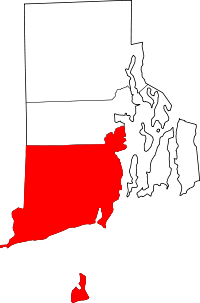
-Thread for travelling between areas within Washington County- Info and picture from Wikipedia-

According to the U.S. Census Bureau, the county has a total area of 563 square miles (1,460 km2), of which 329 square miles (850 km2) is land and 234 square miles (610 km2) (41%) is water. It is the largest county in Rhode Island by total area and the smallest county in the US that is a state's largest county. The county's topography ranges from flat along the shoreline to gently rolling hills further inland. The highest point is a large area approximately 560 feet (171 m) in the Exeter neighborhood of Black Plain;[4] the lowest point is sea level along the coast. The northern boundary, west of Davisville, is approximately 41.60°N. The western boundary, north of Westerly, is approximately -71.79°W.
-Thread for travelling between areas within Washington County- Info and picture from Wikipedia-
According to the U.S. Census Bureau, the county has a total area of 563 square miles (1,460 km2), of which 329 square miles (850 km2) is land and 234 square miles (610 km2) (41%) is water. It is the largest county in Rhode Island by total area and the smallest county in the US that is a state's largest county. The county's topography ranges from flat along the shoreline to gently rolling hills further inland. The highest point is a large area approximately 560 feet (171 m) in the Exeter neighborhood of Black Plain;[4] the lowest point is sea level along the coast. The northern boundary, west of Davisville, is approximately 41.60°N. The western boundary, north of Westerly, is approximately -71.79°W.